TOPOGRAFO CATASTRO MEDICIÓN DE FINCAS
Estado: En línea
Granada Publicado: 02-12
ID: d5xpwd5v
Vistas: 0 veces
Fotos
Detalles
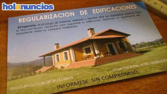
TOPOGRAFíA. Realizamos medición de fincas y parcelas, levantamientos topográficos, deslindes, segregaciones, legalización de edificaciones, cortijos, terrenos, replanteo, corrección de catastro, actualización de catastro, inscripción en catastro, informes y certificados. Mediciones topográficas. Medimos terrenos en Granada y Málaga. Motril, Almuñecar, Nerja, Iznalloz, Campotejar, Benalua, Loja, Vélez, Salobreña, Alpujarra, Huetor, Churriana, Alhama. Topógrafo.
Relacionado
- TOPOGRAFíA. Realizamos medición de fincas y parcelas, levantamientos topográficos, deslindes, segregaciones, legalización de edificaciones, cortijos, terrenos, replanteo, corrección de catastro, ... 02-12
- TOPOGRAFíA. Realizamos medición de fincas y parcelas, levantamientos topográficos, deslindes, segregaciones, legalización de edificaciones, cortijos, terrenos, replanteo, corrección de catastro, ... 02-16
- TOPOGRAFíA. Realizamos medición de fincas y parcelas, levantamientos topográficos, deslindes, segregaciones, legalización de edificaciones, cortijos, terrenos, replanteo, corrección de catastro, ... 06-10
- TOPOGRAFíA. Realizamos medición de fincas y parcelas, levantamientos topográficos, deslindes, segregaciones, legalización de edificaciones, cortijos, terrenos, replanteo, corrección de catastro, ... 01-22
- TOPOGRAFíA. Realizamos medición de fincas y parcelas, levantamientos topográficos, deslindes, segregaciones, legalización de edificaciones, cortijos, terrenos, replanteo, corrección de catastro, ... 12-20
- TOPOGRAFíA. Realizamos medición de fincas y parcelas, levantamientos topográficos, deslindes, segregaciones, legalización de edificaciones, cortijos, terrenos, replanteo, corrección de catastro, ... 12-18
- TOPOGRAFíA. Realizamos medición de fincas y parcelas, levantamientos topográficos, deslindes, segregaciones, legalización de edificaciones, cortijos, terrenos, replanteo, corrección de catastro, ... 02-12
- TOPOGRAFíA. Realizamos medición de fincas y parcelas, levantamientos topográficos, deslindes, segregaciones, legalización de edificaciones, cortijos, terrenos, replanteo, corrección de catastro, ... 02-17
- TOPOGRAFíA. Realizamos medición de fincas y parcelas, levantamientos topográficos, deslindes, segregaciones, legalización de edificaciones, cortijos, terrenos, replanteo, corrección de catastro, ... 02-17
- TOPOGRAFíA. Realizamos medición de fincas y parcelas, levantamientos topográficos, deslindes, segregaciones, legalización de edificaciones, cortijos, terrenos, replanteo, corrección de catastro, ... 03-28
- TOPOGRAFíA. Realizamos medición de fincas y parcelas, levantamientos topográficos, deslindes, segregaciones, legalización de edificaciones, cortijos, terrenos, replanteo, corrección de catastro, ... 04-07
- TOPOGRAFíA. Realizamos medición de fincas y parcelas, levantamientos topográficos, deslindes, segregaciones, legalización de edificaciones, cortijos, terrenos, replanteo, corrección de catastro, ... 04-07
- TOPOGRAFíA. Realizamos medición de fincas y parcelas, levantamientos topográficos, deslindes, segregaciones, legalización de edificaciones, cortijos, terrenos, replanteo, corrección de catastro, ... 05-30
- TOPOGRAFíA. Realizamos medición de fincas y parcelas, levantamientos topográficos, deslindes, segregaciones, legalización de edificaciones, cortijos, terrenos, replanteo, corrección de catastro, ... 05-30
- TOPOGRAFíA. Realizamos medición de fincas y parcelas, levantamientos topográficos, deslindes, segregaciones, legalización de edificaciones, cortijos, terrenos, replanteo, corrección de catastro, ... 12-18
- TOPOGRAFíA. Realizamos medición de fincas y parcelas, levantamientos topográficos, deslindes, segregaciones, legalización de edificaciones, cortijos, terrenos, replanteo, corrección de catastro, ... 02-04
- TOPOGRAFíA. Realizamos medición de fincas y parcelas, levantamientos topográficos, deslindes, segregaciones, legalización de edificaciones, cortijos, terrenos, replanteo, corrección de catastro, ... 02-23
- TOPOGRAFíA. Realizamos medición de fincas y parcelas, levantamientos topográficos, deslindes, segregaciones, legalización de edificaciones, cortijos, terrenos, replanteo, corrección de catastro, ... 02-24
- TOPOGRAFíA. Realizamos medición de fincas y parcelas, levantamientos topográficos, deslindes, segregaciones, legalización de edificaciones, cortijos, terrenos, replanteo, corrección de catastro, ... 02-02
- TOPOGRAFíA. Realizamos medición de fincas y parcelas, levantamientos topográficos, deslindes, segregaciones, legalización de edificaciones, cortijos, terrenos, replanteo, corrección de catastro, ... 06-10